
“The journey of life is like a man riding a bicycle. We know he got on the bicycle and started to move. We know that at some point he will stop and get off. We know that if he stops moving and does not get off he will fall off.” (William Golding)
According to one survey, 43% of all Australians own a bicycle. It’s not clear whether that statistic counts every rusted machine parked with bent pedals at the back of every garage, or every bike gathering dust under a house across the nation, but one thing is pretty clear. There are an awful lot of bikes out there. Bike riding is big in the north east and in Yallambie, the history of cycling is probably a lot more extensive than people generally realize as they pedal around the neighborhood.
The late 19th century saw the world’s first “bike craze” and a proliferation in the number of bike makers. Some of them, like the Dux Cycle Co. of Little Collins St, Melbourne which employed 150 workers, were established locally. The Dux cause was helped when a Dux was used for the first Perth to Brisbane cycle ride in 1897, a distance of nearly 6000km.
Australia found itself literally in the mainstream of the world-wide bicycle boom as it emerged from the financial recession of the early 1890s and by 1897 there were over 150 brands of home grown and imported bicycles to choose from. Innovations such as the tubular steel frame, the ball bearing, roller bearing chain and pneumatic tyres were all products of advanced manufacturing techniques but in practice, any reasonably competent home handyman or bush mechanic could assemble or repair them. While bikes were comparatively expensive to buy they were ultimately a much cheaper alternative to keeping a horse and trap or even to buying regular rail tickets. As Jim Fitzpatrick observed in the introduction to “The Bicycle and the Bush”, his widely regarded book on the history of Australian pedalling, the bicycle: “required no food or water, was two or three times as fast as a horse or a camel, and did not drop dead from eating poisonous plants.”

In Yallambie, Henry Ernest “Harry” Wragge, (born 1880), the youngest son of Yallambie Homestead’s Thomas Wragge, was an early exponent of bike riding in this district. Harry had a life-long fascination with all things mechanical and is known to have owned a bicycle by May, 1896. (Calder: Classing the Wool and Counting the Bales, p145). The first Australian Cycle Show was held in March that year and it would be interesting to know if the teenage Harry convinced his parents to purchase a bike after attending the show.

A photograph in the Bush collection shows a young Harry riding his bike along the Homestead Road in front of the house garden on what is now the Lower Plenty end of Yallambie Rd and another shows Harry at a slightly later date, standing proudly alongside his pushbike in front of the Yallambie stable yard. Harry’s machine was a diamond frame, “safety” bicycle, a style first perfected by Humber in 1890 and known as the “safety” because of the ease and safety of riding one compared to the “ordinary” or “Penny Farthing” type. It is a design that, with few real modifications, has remained the most common bicycle design up to the present day.

Another early rider was Ada Lawrey, the daughter of one of Diamond Creek’s first settlers and a music teacher who at the start of the 20th century used her bicycle to pedal widely around the district giving piano lessons. A photograph shows her inside the gates of her parents’ Diamond Creek home alongside a fine looking machine, complete with a bicycle luggage carrying valise attached to the frame, ideal perhaps for carrying her lunch box and fork, or maybe just a tuning fork.

Cycling clubs were formed in many places and city dwellers travelled on bicycles to places near and far in the country side that were a refreshing change to the grime and factories of inner-city Melbourne. In several of the earliest extant photographs of the Plenty Bridge Hotel, bicycles are seen pulled up outside the building, evidence perhaps of the importance of the old hotel as a stopping place for travellers on the Plenty River on the road from Melbourne to Eltham and beyond.

A 1907 newspaper report in “The Age” described a cycle race organized by the “League of Victorian Wheelmen” and promoted by the publican of the Plenty Bridge Hotel. The route followed country roads from the Plenty Bridge to Bundoora and back again over a “bad course” with “hilly roads and dangerous turns”. For the record, a Mr D Hall won the event, on a handicap.
When I surveyed my old bike at the back of the garage last week with this post in mind, it seemed like it too was starting with something of a handicap. It was purchased nearly a decade ago from a large supermarket chain, familiar to most people in this town, and looked like it was worth what I paid for it that day I went shopping with money for a loaf of bread and came home with a bike.
 My thoughts strayed. ‘Whatever happened to the bike my father brought home as a rusted old frame “found in a paddock”?’ I spent weeks sanding and repairing that bit of scrap metal and then delivered newspapers from it on dark mornings throughout Rosanna. It later took me on trips as far afield as Bendigo and Ballarat and for a while it seemed indestructable but as I recall, died a sudden death one day as I rode home from Heidelberg Park with football boots dangling across the handlebars. The boots became entangled with the front wheel and, with the front wheel motion suddenly arrested, the rest of the bike and associated rider were destined to continue, the resulting Barnum & Bailey circus somersault a clown act to recall.
That’s what happened to it.
What chance today? In the end I wheeled out my wife’s old pushbike from the garage instead, a good looking, red “girl’s” version with no horizontal bar and streamers on the handlebars. The tyres were a bit perished but it had been a fine machine in its day although that day apparently had been some time ago.
“You’re not going out looking like that are you,” my wife said when she saw the overall effect of me sitting astride her glorious, red retro riding road machine in an outfit she said resembled a 1920s bathing costume.
“Why not? I forgive people wearing Lycra don’t I?”
“I’m glad he didn’t ask me,” said the boy not looking up from his iPhone.
“You don’t know what you’re missing. It’ll be just like Pokemon Go.”

TRAILING THE PLENTY RIVER:
The Plenty River Trail is a shared path that leaves the Main Yarra Trail near the confluence of the Plenty and Yarra Rivers in the south and follows the Plenty River valley to a point beyond the northern margins of Greensborough. The Main Yarra Trail is like a wide open highway compared to the Plenty River trail and gets commensurately more cycling traffic as a result.

As I approached the branch to the Plenty River Trail on a recent weekend now past, a tandem bicycle flew past me on a journey down the Yarra, its riders grinding away at the pedals on the level flood plain of the Yarra Trail to achieve a missile like velocity. ‘Cripes, I’d like to see them try that on up there,’ I thought to myself as I looked at the incline that is the start of the Plenty River Trail.

“Daisy, Daisy, give me your answer, do,
I’m half-crazy all for the love of you.
It won’t be a stylish marriage –
I can’t afford a carriage,
But you’d look sweet upon the seat
Of a bicycle built for two.”
The Plenty Trail leaves the Main Yarra Trail at Viewbank at this point and rises quickly to the vicinity of the old Viewbank Homestead archaeological site, an ascent of about 30m where commanding views are to be had out across Bulleen and Templestowe. The day I was there a fine winter breeze was blowing and enthusiasts were flying a large model sail plane out over the valley. It was presumably radio controlled since like a boomerang, it kept coming back no matter how many times they tried to get rid of it.

Beyond this, the path crosses Banyule Rd and runs in a straight line alongside Hendersons Rd. It passes a pony club where it descends steeply to a point at the end of Martins Lane where, as mentioned previously, my wife’s great grandfather once kept a spectacularly unsuccessful chicken farm.
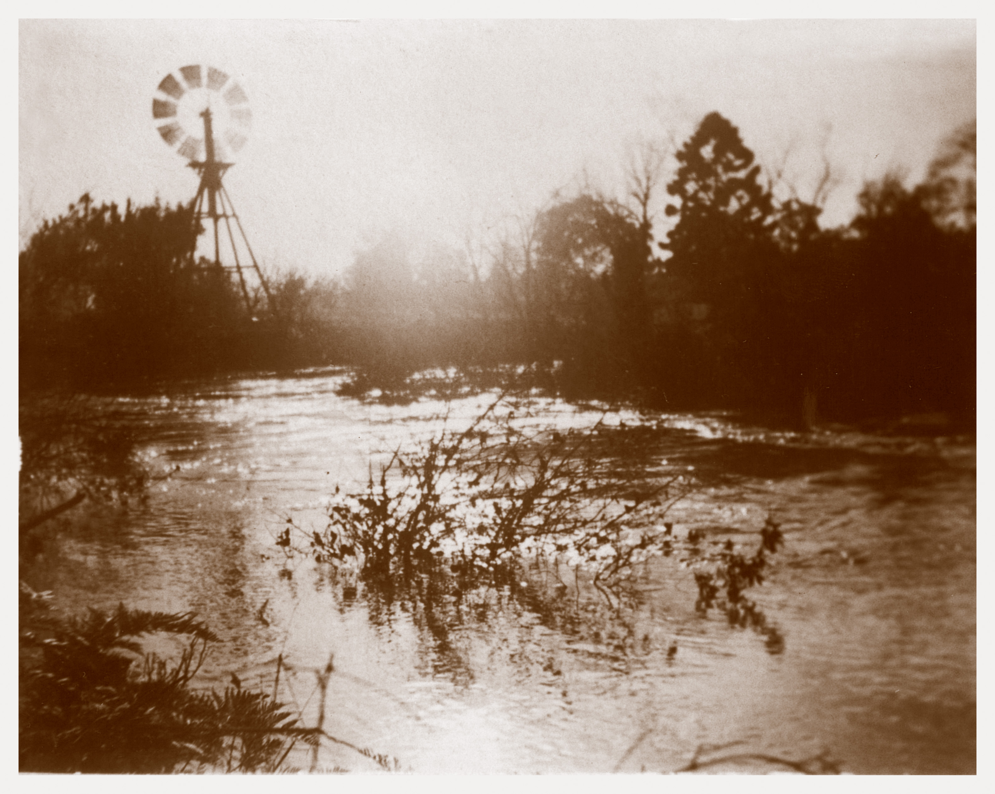
The Trail then crosses the Plenty River, the first of many crossings, and follows a route at the back of Heidelberg Golf Club between the Club and the River. For many years this was the “missing link” in the trail as the Golf Club and Council struggled to come to an agreement about the siting of the path and a bridge. After agreement was reached, the link was finally opened to riders and pedestrians in March, 2007.

Crossing the River again via the Old Lower Plenty Road Bridge adjacent to the former site of the Plenty Bridge Hotel, the Trail is then in Yallambie territory proper.
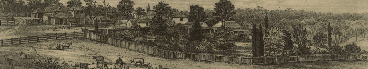
It passes the Yallambie Tennis Club and the Soccer Ground before rounding out onto the Yallambie common at the next bend in the River. The well-remembered “Lone” Hoop Pine, oak trees, cypresses and remnant orchard are the neglected features of the National Trust Classified landscape that can be found here.

Beyond this are the locations of William Greig’s 1840 farm and William Laing’s Woodside (Casa Maria), the site of the latter being marked by several ancient Italian Cypress trees which can be seen standing on a ridge high above the River.
The path then splits in two and there is a choice of following it for some way on either side of the River, a relic of the days when the River marked the boundary between the Shires of Diamond Valley and Eltham and the two banks were under separate administrations. Today the whole of the Plenty River Trail falls within the Municipality of Banyule with Yallambie at its centre.
Up river, the Montmorency Football Oval on the eastern or “Monty side” covers the site of a former tip. Wonder in awe at a time when it was thought environmentally OK to use a river landscape as a tipping ground! The area is well maintained but if you look closely at the river bank below the oval you can see some evidence of its previous use at places where the bank is eroded.

After Montmorency Secondary College is passed, the Trail arrives at the Willinda Park Athletics Track where it becomes a single path on the western side of the River. On the eastern side, the factories on Para Rd show their backs to the River but even here wild life can be found. I stood looking from a distance at what I thought was a tree stump at the back of the factories, trying to make my mind up about what I was looking at. Then it moved and the kangaroo I had in fact been watching, hopped away and out of sight.
At what was formerly the northern most boundary of the old Montmorency Farm, Para Rd and the Greensborough/Eltham single track railway cross the River using separate bridges and here the Plenty River Trail appears for the moment to end abruptly in a residential court. The Trail is not well sign posted throughout its length but at this point it leaves you guessing completely about what course to follow next. The answer is to travel about 100m along Bicton St and resume the Trail at the far end.
At Poulter Reserve the Greensborough rail station can be accessed by riders who have had enough and want to return home via a train or cross to the looming ugly presence of the Greensborough Plaza for a café latte.
Further on, the Trail crosses the River again under the Main Street Bridge next to the remains of the old swimming pool that was built in the Depression within the bed of the Plenty River itself.

Lost history abounds here. A photograph of bicycle riders at the original blue stone bridge in 1897 is another reminder of the area’s historic popularity with riders. The original 1864 blue stone bridge was removed progressively from 1974 until 1983, its massive blue stone buttresses being turned into a barbecue on the corner of Main St and St Helena Rd above in what was surely a loss to local history but a win for sausages.

A dinky little suspension bridge crosses to Whatmough Park on Partington’s Flat where the original farm, Willis Vale, was formerly situated until being burned out by a bushfire in the 1950s. Local football is played at many of the ovals along the River on any given weekend and the day I was at Partington’s, a DVFL game was in progress between St Mary’s and Epping. It might have been a reserves game but it was very popularly attended and an example of how I remember footy used to be played. The skills were of course a long way short of AFL standard but for all that, or perhaps because of it, I found it was a very enjoyable game to watch. Forget the “flood” of players up the ground, a feature of AFL football in the modern day. I saw a bit of mud, a bit of biffo and a full forward who stayed rooted to the goal square, waiting for the ball to be kicked to him.
And further to the record, after trailing early, St Mary’s beat Epping 11.16 to 9.3.

Up-river from Partington’s, the Plenty River Trail passes under the Greensborough Bypass Road which crosses the River on an elevated roadway high above. A plane could fly under it. A Zeppelin could park under it. At this location there is an un-signposted “goat track” from Plenty River Dr at a point just about opposite Booyan Cres. The “goat track” is a mountain bike switch back but by successfully negotiating the mud for a short distance access can be gained to the Greensborough Bypass Cycle Path and thence to the Metropolitan Ring Rd Trail. By all reports you won’t find a single B-Double semi travelling in the outside lane.
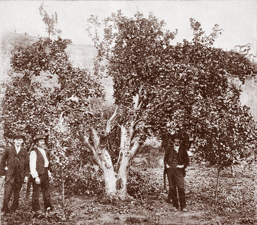
Staying on the Plenty River Trail the path arrives at the so called “Batman Apple Tree” next to an easement below Corowa Cres and adjacent to the old Maroondah Aqueduct Pipe Bridge.

Nearby the Pioneer Children’s Cemetery holds the unmarked graves of children from the Whatmough and Partington families, early settlers on this part of the River. Not far beyond is the official end of the Plenty River Trail at the base of a flight of stairs leading down from Punkerri Circuit.

Although it is sign posted to this effect the trail is actually longer than its official 12.3km length and follows a path further along Dry Creek, the merry sound of water running nearby which surely belies its name. The track passes through a closed gate and along an unmade path to an easement running between Plenty River Drive and Mclaughlans Lane where the 520 bus to Doreen has a stop on Sugar Gum Blvd. This is the final end of the Plenty River Trail but the vicinity also marks the south eastern approaches to the Plenty Gorge Parklands, whose mountain bike adventure trails beckon more determined riders.
But that’s a whole other story.
