
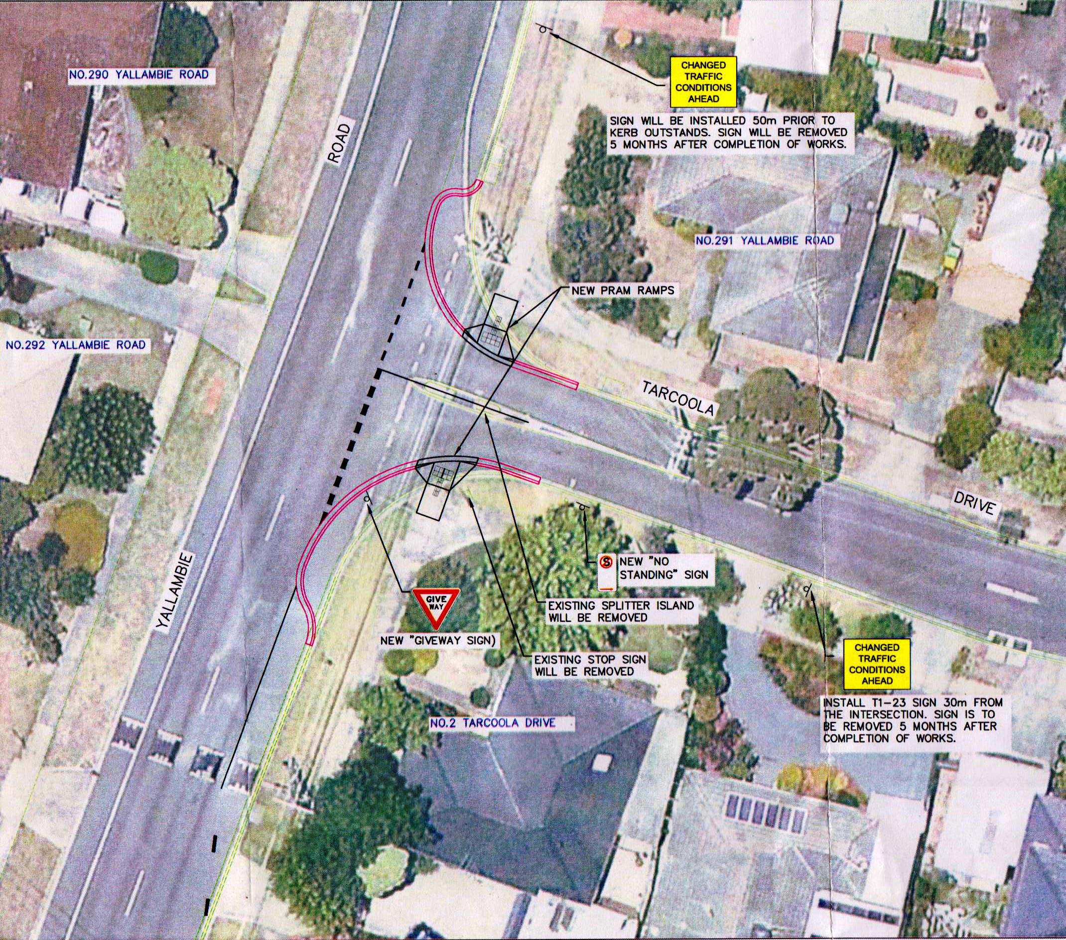
It’s a bit of a cliché, but the incongruous sight of men leaning on shovels around a road sign announcing the apparent falsehood, “men at work”, is one we are all familiar with. In Tarcoola Drive, Yallambie at the start of April one such sign went up on the nature strip near the corner. It read “roadwork ahead”, a precursor to sawn lines being cut into the road surface in front of it, then – nothing. It has been like that for a month, a road hazard if not actual roadwork, evidence that somebody at the road depot at least has a sense of humour. There the sign has stood forgotten, oblivious to traffic and to all intents and purposes seemingly abandoned. Eventually a motorist missing the corner drove right on over it, bending it into a shape like banana or a boomerang made by an First Nations Aussie on a bad day.
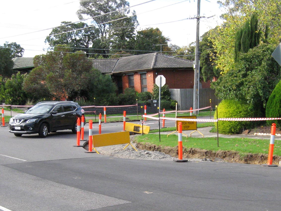
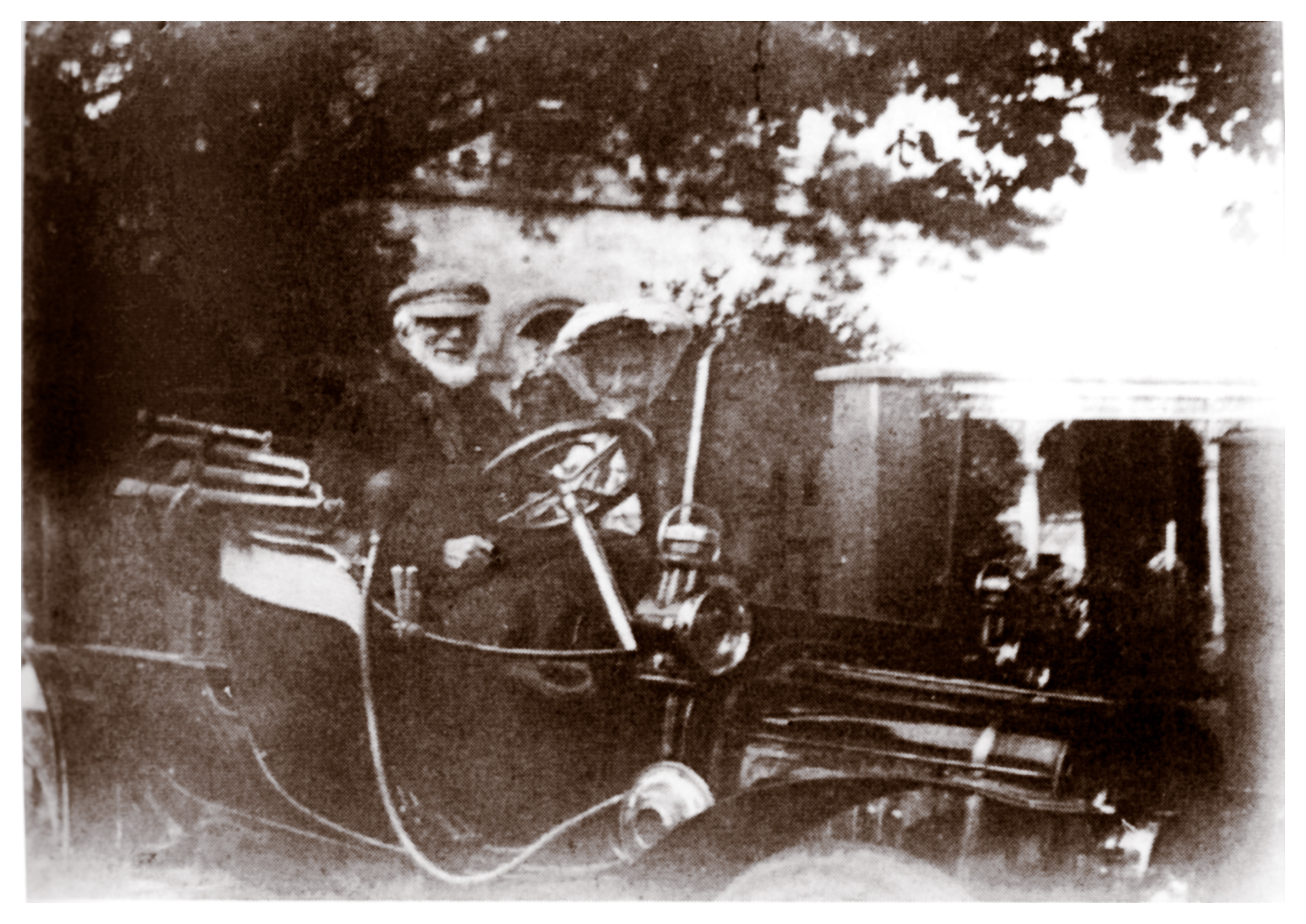
The intention I’m told is to build new kerb “outstands” on the corner. These projecting kerbs are intended to reduce the speeds of vehicles entering and exiting Tarcoola Drive by making the turn disproportionately more dangerous. Yallambie’s Thomas Wragge, who owned one of the very first motor cars in the Heidelberg district, is said to have preferred a horse and cart. He may have been right.
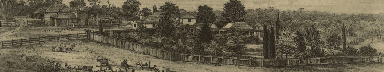
Roads were an early priority of this area and it has been argued by D S Garden that the creation of the Heidelberg Road Trust in 1841 constituted the earliest known form of local government within the Port Phillip District. The road to Heidelberg had been formed in 1839 and was known initially as the “Great Heidelberg Road”. It was laid out by the surveyor J Townsend who followed a line that was more or less parallel to the Yarra River.
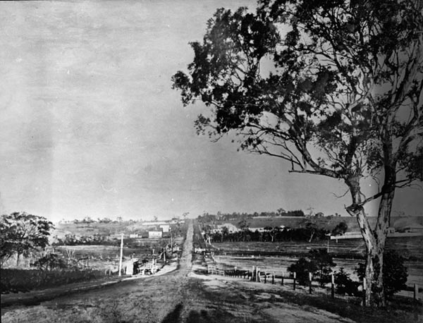
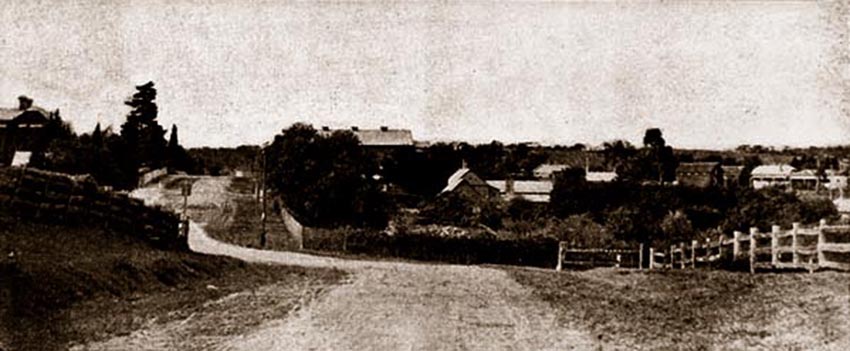
I picture Townsend in those far off days whistling the highs and lows of “The Bonnie Banks of Loch Lomond” as he surveyed his route, the design splitting Heidelberg Road into two paths after the Darebin Creek ford. His Upper Heidelberg Road, known initially as the Nillumbik Road, ran along the top of the ridge while the Lower Heidelberg Road, first called the Mount Eagle Road, followed the valley contours.
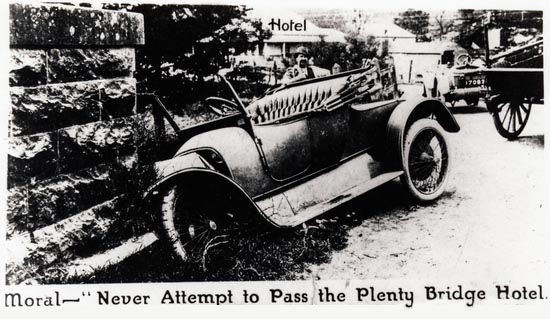
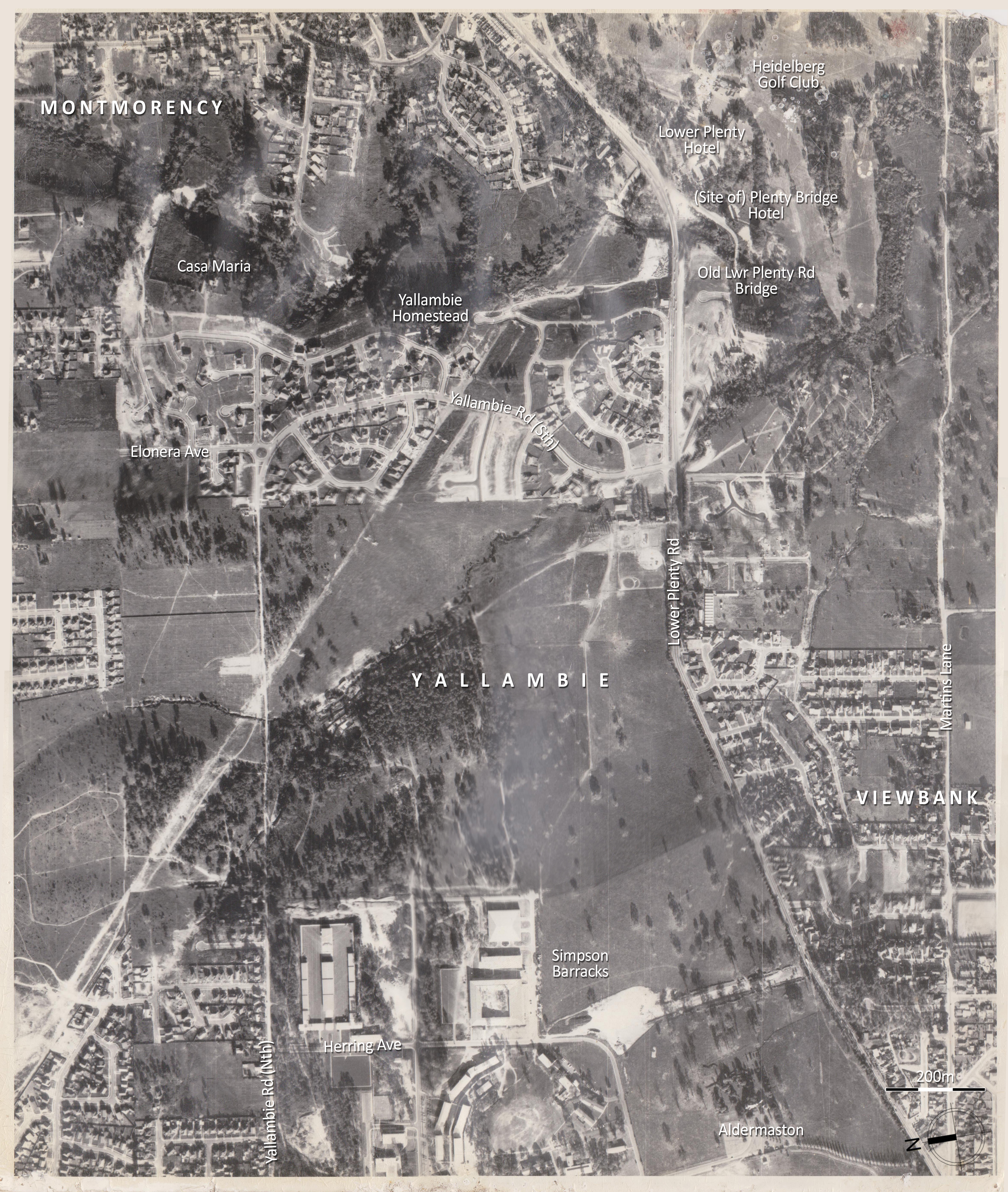
The Heidelberg Road commanded regular traffic from its inception. The route beyond to the Diamond Valley and Lower Plenty initially led to a ford over the Plenty River near what is now Martins Lane. Although shorter this route was discarded in 1840 in favour of the current line which was considered easier. William Greig, who as recounted previously farmed at Yallambie in that year, used this way regularly to visit town. That was until the early perilous condition of its surface sent his pony lame. Richard Howitt meanwhile, who lived on the Heidelberg Road at Alphington and who we remember for his visit to his Bakewell brothers in law at Yallambee in mid-1842, was equally unimpressed.
A beautiful town is Melbourne,
All by the Yarra’s side;
Its streets are wide, its streets are deep –
They are both deep and wideEscaping from one quagmire,
There’s room enough for more;
Such a beautiful town as Melbourne
Was never seen before…
(Richard Howitt, Impressions of Australia Felix, p299)
One of the first tasks of the Heidelberg Road Trust then was to macadamise the road surface, a process that was commenced in 1842 and which was to introduce a technology which had not long been developed in Britain. The metal for the project came from a bluestone quarry at Alphington on the west bank of the Darebin Creek. As the colony emerged from the economic stupor of the 1840s, visitors to the Heidelberg district were astonished by the experience of travelling on a luxury road that boasted an incredible macadamized surface, the first in the Port Phillip District. In March, 1848, Bishop Perry wrote after travelling on this road that:
“Yesterday we drove to Heidelberg, which is the most settled part of the country. The distance from Melbourne is about eight miles, and the road is the only made road in the colony… Here and there we went along, were neatly piled up heaps of broken stone, ready for mending the road, just as you see in England; and at places we found men at work with shovels levelling, filling up holes etc.”
Almost a decade later in 1857, an attempt was made to reform the Heidelberg Road Trust by declaring the district a municipality. It failed after a petition opposing the move, led by the leading gentry of the region, was delivered to the government. Yallambee’s Bakewell brothers must have been getting ready for their return to England when they signed but all the same, their names appear there near the top of the parchment alongside such luminaries as Hawdon of Banyule, Martin of Viewbank, McArthur of Chartresville and what amounts to a mid-19th century virtual who’s who of the Heidelberg district. It appears there had been some disagreement over which part of the Heidelberg Road would most benefit from spending of the available road finances. The Bakewells, preoccupied with their return to England, possibly believed no money should be spent on it at all.
Transportation has changed and roads might be different but disagreements about spending on infrastructure hasn’t changed that much in the one and a half centuries since. The present State government dropped more than a billion dollars to dump the East West Freeway when it came into office, all to prove a point. In the State Budget announced today, the same government released plans to spend another $100 million on a feasibility study of a North East Link, the so called missing link between the Western Ring Road and Melbourne’s south east.
The North East Link is an old idea that harks back nearly half a century to the “1969 Melbourne Transportation Plan” which it might be argued was an attempt to turn Melbourne into a Los Angeles of the south. They largely succeeded in that plan for as a contractor once told Arthur Dent shortly before his planet was demolished by the Vogons, “It’s a bypass, you have to build bypasses.” The glaring exception however was the freeway that was to have been built through Heidelberg. Carrying the moniker F-18, the 1969 plan was to drive it through the Heidelberg community like a Thunderbirds’ atomic road maker, road laying machine, cutting a swathe through the landscape. Thankfully the plan was abandoned in the early 1970s and the land in Buckingham Drive and Banyule Road at either end of the freeway reserve was later sold for housing. The Freeway reserve is still there in between in the form of a linear park but the plan is now to either build a tunnel under the City of Banyule or direct the route further out through Nillumbik Shire. Either option fills nearby communities with impending dread.
In Banyule, on a local and I might say, somewhat “smaller” scale, the City Council set aside $38,000 in the 2016/17 Budget for the work near us in Tarcoola Drive mentioned at the start of this post. However, they tell me that they are determined to spend only about half of that amount this year, the rest being put aside presumably for when they feel like coming back to do the job properly. Maybe they’ve run out of money already.
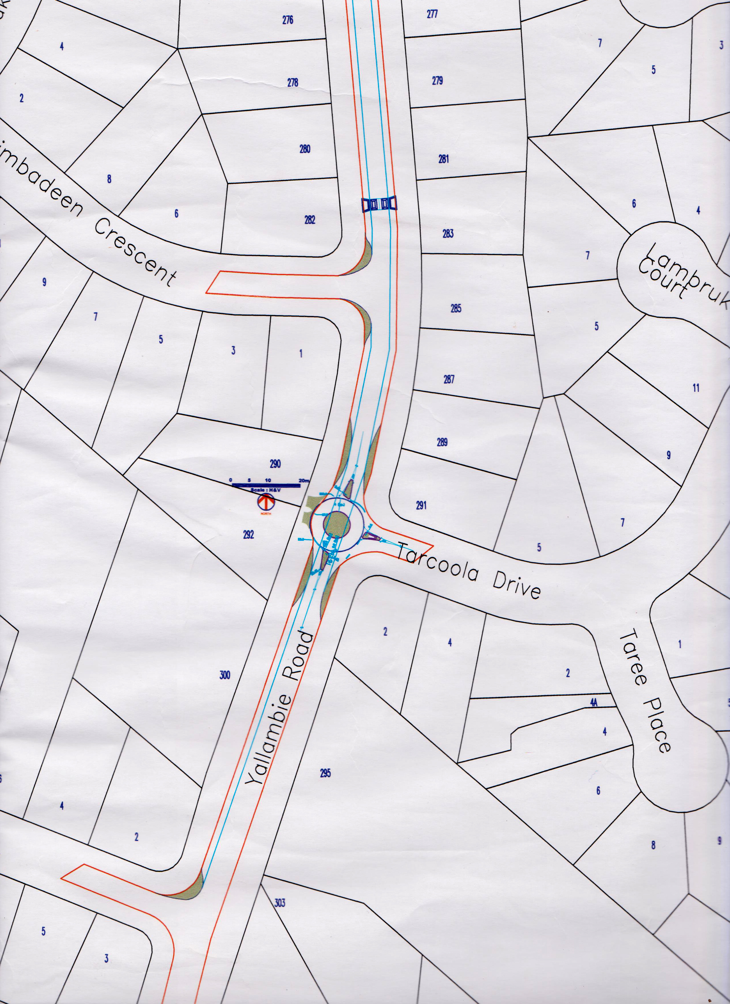
Like the F-18 on a larger scale, this is not the first attempt to deal with a perceived traffic problem in Yallambie. In the mid ’90s there was a proposal drawn up to transform the same corner into a retro fitted roundabout, a project aimed at slowing traffic in Yallambie Road, as opposed to the current attempt at slowing traffic in Tarcoola Drive. That roundabout was never built, but was constructed instead onto the corner of Binowee Avenue and Yallambie Road near the shop with speed bumps formed at the approaches.
To add a bit of currency to an old problem, yesterday afternoon our son came in from school and said that as he crossed Lower Plenty Road to Yallambie Road with a green pedestrian light, he had”nearly been run over by a car turning the corner.” In 1993, during the development of Yallambie’s Streeton Views subdivision, the Traffic Engineer for the project Greg Tucker reported that a grade separated pedestrian overpass across Lower Plenty Road to the schools in Viewbank was unwarranted. “The provision of traffic signals at Grantham and Crew Street would incorporate pedestrian crossing facilities in any event…” (City of Heidelberg business paper, 8 Feb, 1993). In subsequent developments, the Martins Lane intersection was substituted for Grantham Street.
I’ve heard tell that it used to be an unofficial policy at VicRoads to undertake remedial roadwork but to do so only after a road death had occurred. A bit like shutting the barn door after the horse has bolted. The profusion of roundabouts and speed bumps at the northern end of Yallambie Road are something that was added after 1980 and only after the pedestrian death of a child on Yallambie Road near the Primary School. In those days Yallambie Road was a sort of alternative route to Eltham bound traffic on Greensborough Road. The 46 page “Yallambie Road Traffic Study” prepared by Nelson English, Loxton & Andrews for Heidelberg Council in 1982 reported that approximately a third of all traffic on Yallambie Road was through traffic and that up to 78% of traffic exceeded the then maximum 60 km/h speed limit with the highest speed recorded at 100km/h. The report also noted that the impending signalisation at both ends of Yallambie Road was expected to result in even more through traffic.
The decision three years later to extend Elonera Avenue, Yallambie in the City of Heidelberg through to Elder Street, Greensborough in the Shire of Diamond Valley as a part of the Daniel’s sub division opened up another access point into Yallambie, This time from Greensborough in the north. The Yallambie Community Association which was a then very active institution, strongly opposed this connection, but their collective voice remained carefully ignored by those who make the decisions. Once again the ad hoc solution has been to retrofit speed humps, this time along Elonera Avenue.
The folly of creating communities without satisfactory infrastructure is nothing new. What happened at Fishermen’s Bend in Port Melbourne is a case in point and is a classic example of what can happen when the profits of a few investors and developers are put ahead of the interests of the wider community. At Fishermen’s Bend, a few property developers, mostly with connections to the then Liberal State Government, became insanely wealthy overnight when the former industrial land they had invested in was rezoned with a stroke of a pen to allow multistorey apartment buildings. Some individuals made profits of over 500% on their investments but planning for residential infrastructure such as schools and roads was almost completely disregarded in the process, leaving taxpayers to pick up the tab at a later date. It has been described as a classic example of how not to develop land ear marked for urban renewal.
Sometimes it’s not about what you know but who you know along this highway of life. The Premier of Victoria at the time of the release of the 1969 Melbourne Transportation Plan freeway blueprint was the legendary, late Sir Henry Bolte. Ol’ Henry reportedly enjoyed a tipple now and then but in March 1984, long after his retirement as Premier, Bolte suffered serious injuries when the car he was driving collided with another vehicle near his home. Surveys here and abroad have consistently reported that the majority of road accidents happen near our homes but in this case it was alleged at the time that Henry had been drink driving. In the end, charges were never laid after the police mysteriously “lost” the blood sample taken from the injured ex-Premier after his crash.
Bolte recovered but his legacy remains in the testament of the road network that he envisaged and that has been built right across greater Melbourne. Maybe one day we will all be travelling in driverless Tesla cars on this network, but the vote as far as it affects Banyule remains out.
 Personally my money’s all on a future involving the Jetsons’ flying car.
Select sources: Heidelberg - The Land and Its People, D S Garden; The Diamond Valley Story, D H Edwards; The History of Our Roads, Maxwell Lay in The Heidelberg Historian, June 2005; Yallambie Road Traffic Study 1982, Nelson English, Loxton & Andrews; Yallambie Community Association papers; City of Heidelberg business paper, Feb 1993
